Environmental resource mapping
3 min read
Guest author: Olga Chepelianskaia (UNICITI)
Editor's note: This post reviews the importance of mapping local environmental resources using diverse data to support agricultural practices in the state of Karnataka (India). The post is the second one in the three-part series entitled 'Mapping: a tool to build urban resilience'. The premise for this post is that agricultural resilience in a rural setting is fundamental for wider urban and societal resilience. See here for the first post about community-led heritage mapping in Kathmandu, Nepal.
Rain-fed agriculture plays an important role in Asia’s economy. More than 60% of agricultural land in South Asia is rainfed (FAO, 2005). Rain-fed agriculture is vital in India too. The country has nearly 180 million ha of cultivable land (The World Bank, 2016), which employs 50% of the country’s workforce.
However, this resource is vulnerable to climate change. Over 40% of this land lies in drought prone areas, while 54% of India’s net sown areas are dependent on rain. Over 150 million ha of the country’s cultivable land are eroded because of floods (Suhas P Wani, 2009).
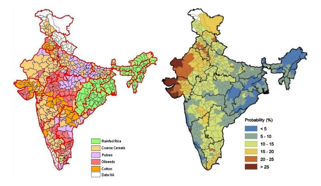 Left: Major rain-fed districts in India and their major crops.
Right: India’s drought proneness
Source: Rao et al. 2015 and Resource Research
The State of Karnataka, India, illustrates the situation well. Nearly 80% of Karnataka’s land falls in drought prone areas while they heavily rely on groundwater. Since 1990, this resource faced an excessive pressure, which led to a sharp decline in water levels and deteriorated the water quality. These conditions directly affect the livelihoods of farmers across the State. In such a context, efficient water management becomes a question of survival for them.
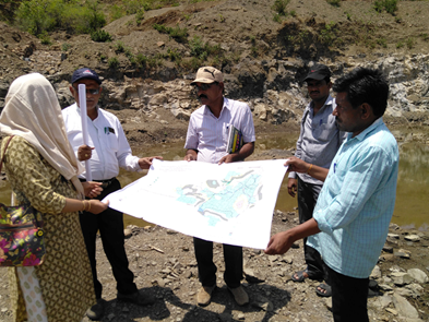
Field verification by TERI in Kalaburgi's Dotikola village. Source: TERI.
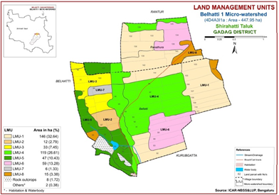
A thematic map in LRI atlas. Source: TERI
Realizing this, the Watershed Development Department of Government of Karnataka (WDD) and the State Department of Horticulture (DoH) joined forces to start Karnataka Watershed Development Project-II. Locally known as SUJALA3, the project brings effective watershed management through science-based approaches. One of them is mapping the local resources in 3 steps:
- Resource Mapping: Information on soil and land use was mapped at a farmer field scale by the National Bureau of Soil Survey, Land Use Planning (NBSSLUP) and the University of Agricultural Sciences, Bangalore. Information about local watersheds, ground water content and crop cycles were documented in detail.
- Data Atlas: Based on this in-depth mapping, a Land Resource Inventory (LRI) atlas was developed for each local watershed area. The LRIs are a comprehensive assimilation of the mapped local resources. They detail site-specific information on the soil texture, moisture availability, suitable crops, nutrients and site-specific farming techniques.
- Accessible Knowledge: Lastly, the LRIs were made in the local language.
This mapping exercise at the field level helped farmers select best suited crops based on the amount of water and the type of soil they had. As a result, farmers reported an average increase of 100 kg per harvest. Resource mapping can also help incorporate climate change projections and help farmers climate proof their activities.
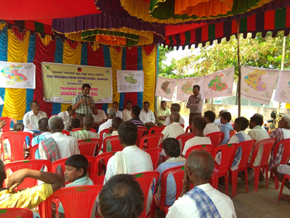
LRI training given to farmers in Davangere, Karnataka. Source: TERI
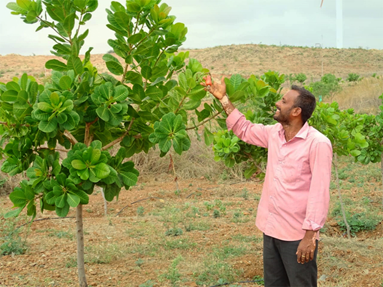
Farmers have reported an average increase in produce of 100 kgs per harvest. Source: TERI
Links for further reading
https://www.oav.de/fileadmin/user_upload/5_Publikationen/5_Studien/170118_Study_Water_Agriculture_India.pdfhttps://www.teriin.org/article/karnataka-adopts-new-approach-enhance-impact-watershed-programme
Biography

Olga Chepelianskaia is principal consultant and founder at UNICITI. Olga has international technical field experience in over 20 Asian cities and 40 Asian countries, conducted in the frame of programs and projects implemented for a number of international development institutions such as the ADB, CDIA, UNECE, UNEP, UN ESCAP or UNDP.
When you subscribe to the blog, we will send you an e-mail when there are new updates on the site so you wouldn't miss them.
Comments 3
[…] to build urban resilience’ (see post 1 about community-led heritage mapping, and post 2 about environmental resources mapping for sustainable agriculture). This post highlights the value of cognitive mapping to grow our […]
[…] Environmental resource mapping by Olga Chepelianskaia […]
[…] One can name just a few topical blog posts published between 2017 and today: critical reflection, environmental resource mapping, environmental and architectural heritage, sustainable architecture, web-based public […]