Digital adaptations & reflections: from people to planet
Read time: 5 minutes
In a time of global crisis, the digital keeps us connected and providing us opportunities to adapt and reflect both individually and collectively. This post shares some digital adaptations and reflections that stretch from the individual to the global level, with relevance to spatial planning and construction.
The current global crisis reveals both significant gaps and opportunities for more resilient spatial planning and collaboration in our highly networked world. Physical places and space are out of reach for many of us at the moment, while others are busy keeping essential services or tending the sick. At the same time, the digital is keeping us connected as never before. It is expected that digital and mixed reality solutions will grow in the near and medium future, and help us to further manage ourselves, collaborate with others, as well as visualise, navigate, analyse, manage and shape places and spaces remotely and/or on site. Digital adaptations are here to stay, and grow.
Individual adaptations
Mindfulness. At the very individual level, one of the best thing to do in times of crisis, besides observing public health guidelines, is to keep calm. Mindfulness apps can guide or support you in restoring inner calm and focus, particularly if you are not used to activities like meditation.
- Twelve mindfulness apps to help you calm during a crisis, shared by Lydia Willgress on the Independent.
- Five mindfulness apps shared by Kira Newman on Mindful.org, The website also hosts a suite of resources for the covid-19 crisis.
- On the research side, the University of Oxford Mindfulness Centreis a leading research centre that substantiates the benefits of mindfulness in people's lives.
Online learning. Online learning and teaching can be expected to boom in the near future. This can range from growing demand for MOOC platforms (e.g. Coursera, Udemy, FutureLearn, CodeAcademy, and many others) to universities likely developing advanced learning platforms for their own students. Many websites also provide resources to improve soft skills, such as Mind Tools, among many others.
Tools for collaboration & events
For academics and professionals, online collaboration is a clear adaptation to working from home. Collaboration and mixed reality tools are of vital importance for professionals in architecture, engineering and construction. People in all industries will increasingly rely on collaboration such as Trello and Microsoft Teams, discussion tools such as Slack, and and video-conferencing tools such as Zoom.
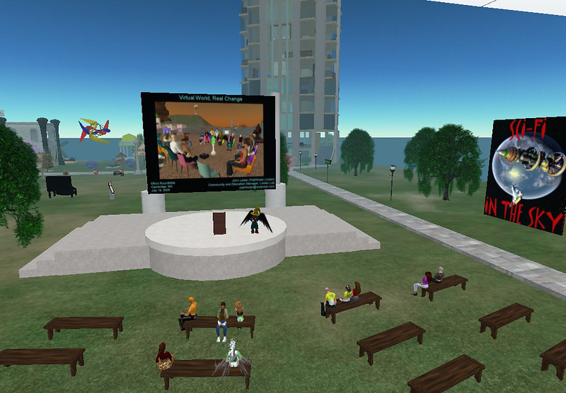
Events and meetings can still be done virtually through platforms such as Second Life. Already in 2009, Marcus Foth explored the possibilities for the second life of urban planning through a range of 'neogeography' tools that facilitate participation of even the less tech-savvy. To these we can add various online serious gaming
Neighbourhood apps
NextDoor is a leading neighbourhood-based app in several countries around the world, enabling residents to share information and help each other, which is acutely useful in this time of pandemic. In France specifically, a number of neighbourhod-based apps are flourishing to promote social life, inclusion, and mutual help between neighbours, such as Ensembl', Ma Vie de Quartier, or Smiile. Ensembl' also fosters partnerships with local authorities and housing professionals.
Digital spatial planning & construction
The current crisis has left its mark on the planning and construction industries. Diana Budds on Curbed traces the capacity of spatial planning to handle epidemics from a historical perspective, starting with Ancient Greece, and discusses implications for the current crisis. Resilient urban design is the key to managing wide-sweeping crises, although clearly there is no simple way to do this. The impact on the world economy will be felt. From a UK perspective, construction sites and manufacturing are encouraged to keep going so long as workers can work safely.
Construction. the growing digitalisation of design, workflows, information and processes is exemplified in Building Information Modelling (BIM). In an ideal world, BIM models enable stakeholders and clients to collaborate and manage physical assets seamlessly over the course of a building or infrastructure's life cycle. Improved collaboration and integration of information, data and processes through BIM can only be expected to grow. Building contractors worldwide are also reaping the benefits of various forms of digital data collection (e.g. Skanska). Regarding environmental assessment, Royal Haskonig DHV leverage a digital format for Environmental Impact Statements. In short, all aspects of the built environment are undergoing intensive digitisation.
Spatial Planning. 3D visualisation tools such as OpenCities (CityPlanner) can be used for internal project management within planning departments, as well as to enable various forms of citizen participation in many Swedish cities. In a former post, Enzo Falco and Reinout Kleinhans shared a comprehensive list of digital participatory platforms that can help support citizen participation in spatial planning. More generally, the tech sector is becoming increasingly pervasive in the shaping of cities, from Google's Alphabet in Toronto's Waterfront, to swathes of sensors and increasingly interconnected ICTs as the backbone of smart cities where planners could (or should) take the driving seat. A BIM approach to cities can also be upscaled to entire cities, placing spatial planners as key market actors, which would rely on an extensive spatial data model.
Digital Twins: a tale of two cities. Building on the above, a related trend in both architecture, planning, engineering and construction is the emergence of digital twins. Digital twins are digital replica of physical entities, which can include buildings, cities or even entire countries. In the UK, for example, the Infrastructure Client Group (part of the Institution of Civil Engineers), is working with the Cambridge-based Centre for Digital Built Britain to produce a digital twin for the whole of Britain. The latter can be integrated in smart city strategies. Virtual and digital twins are readily used in urban planning, for the production of plans as well as citizen engagement, drawing on game tech such as Minecraft, or the aforementioned digital platforms for citizen participation. The city of Rotterdam is actively building a digital twin of the city, which could be coupled with insight from open data and the analytical powers of Artificial Intelligence (AI). Among many others, other cities include Virtual Singapore, or Amaravati, the new capital of the Indian state of Andhra Pradesh, which is thought to be the first entire city born with a digital twin.
As the built environment and cities becoming increasingly digitised, the line between digital and physical realities will become increasingly porous and... virtual. Our world is increasingly one of mixed reality, as presented in a former post on hybridity in placemaking.
A mixed reality event in Boston as early as 2006, hosted in . One of many examples of mixed reality applications. Mixed reality: the new norm for urban dwellers and professionals within the spatial planning, design and construction industries? Picture credit: Beth Kanter on Flickr, Generic CC Attribution.
Planet
Our planet has a digital twin too. Google Earth enables you to see the whole world in 2D and/or 3D on the web, and also to learn about places. When you can't go places physically, the web always allows you to visit them virtually.
The digital is also used for surveillance worldwide. The current crisis bears implications for democracy, governance, public health, privacy and urban security at the global level. In a recent article in the Financial Times, Noal Yuvah Harari maps the authoritarian dangers and democratic opportunities of the world after covid-19, demonstrating that the way we respond globally to the covid-19 crisis can have lasting effects for the years to come. Harari identifies two main possible scenarios: one toward global disunity and mass-surveillance, and another toward global solidarity. We should be conscious of the implications of each.
To conclude, resources such as Yann Arthus Bertrand's Human and Planet Ocean, and David Attenborough's lifetime worth of fascinating documentaries (e.g. Seven Worlds, One Planet), remind us of the preciousness and wonders of life on earth, and of the interdependence between all humans. As we continue to adapt digitally, we cannot afford to lose sight of the precious planet which sustains all life, and of our fellow human neighbours, past, present and future.
When you subscribe to the blog, we will send you an e-mail when there are new updates on the site so you wouldn't miss them.
Comments 2
[…] research or participatory planning purposes. In a previous post, I blogged about a wide range of digital adaptions and tools relevant to the field of spatial planning. This post focuses on online workshops, and briefly […]
[…] Digital adaptations & reflections: from people to planet by Ian Babelon […]